
Operated by a 1A certified team
Photogrammetry, mapping, volume determination and 3D
Photogrammetry is, briefly explained, measuring with photos. Based on photos we have obtained via remote sensing, we build a model that can be used to measure with accuracy. Of course, there is a bit more involved in this than a ruler.
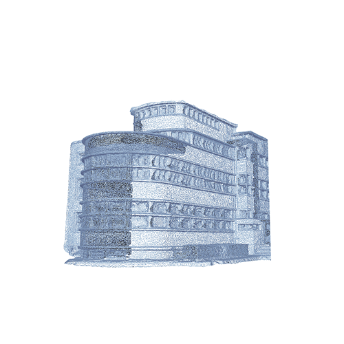
A drone is equipped with an onboard GPS and records exactly where every photo is taken, meaning that every picture is tagged with XYZ coordinates. With all these photos being geographically placed in the space, a scatter plot is formed, the basis of a 3D model.
The challenge lies in recording good quality and consistent data in order to deliver correct results. After all, it is the final result that counts rather than the method of collecting the data. Thanks to the visualization of this big data, better decisions can be made.
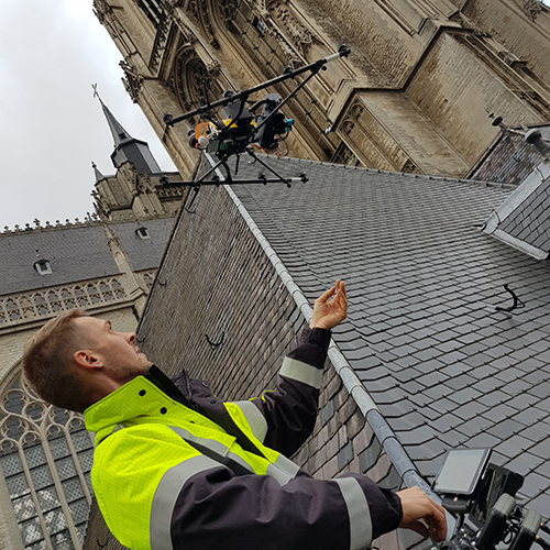
Our surveying drone is equipped with an RTK/PPK (Post-processed Kinematic) system that drastically improves the accuracy on the vertical axis and at the same time reduces the amount of control points needed.
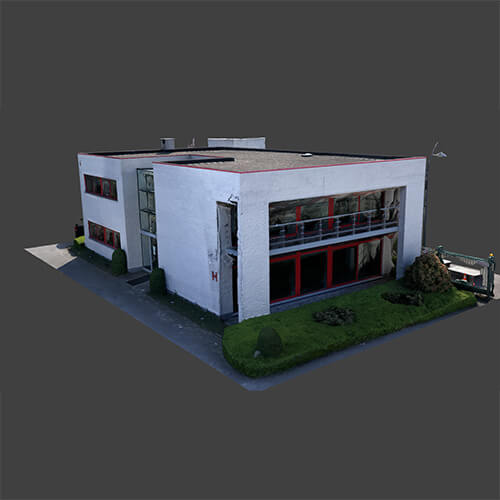
We can reproduce the largest and most challenging 3D models of existing infrastructures, derived from photos and/or points obtained from a 3D scan. How would you like having a lifelike cathedral or nuclear cooling tower displayed on your computer?
Our 3D models in photo quality are full of details and spatially correct. They can, therefore, be used to make operational decisions. Project managers can use this smart data in every step of their operation from design to maintenance.
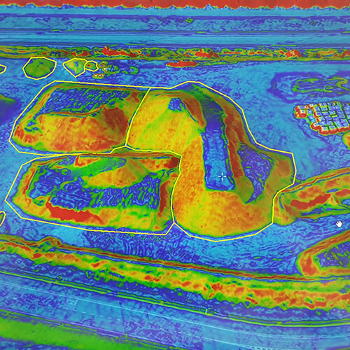
Accuracy is an important criterion for UAV mapping projects. For example, when calculating volumes of sand stockpiles, landfill sites and quarries. The drone flies according to a predefined route and takes overlapping photos of the area to be measured. This is how data is generated for orthophotos, DEM’s (Digital Elevation Models), 3D models and scatter plots, which can all be integrated into your GIS workflow. The accuracy is guaranteed by measuring ground control points with surveying GNSS measuring equipment.
The evolution of a project can also be mapped by importing existing traditionally measured reference planes, models and scans and comparing these with the current situation.
Curious about what else we can do for you?